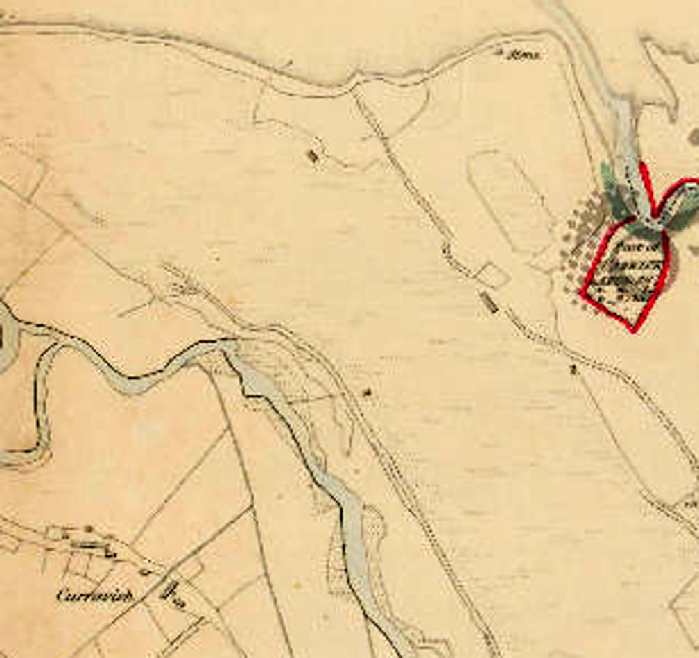


The OS maps reveal more information about the Corvish Stone which was discovered recently. (See earlier post) The first edition of the OS 6-inch maps 1834 shows a “Stone” here but it had disappeared in the 1900 edition. The stone with the carving is most likely the original standing stone listed 200 years ago. Clearly, it has undergone a process of recycling. Thankfully, it was not used as a door lintel or in land drainage, as was the fate of many of our standing stones. I assume the McLaughlin family recognised its importance and preserved it behind the house, where it was found. The Corvish Stone is an important part of the heritage of Carndonagh parish.
Note the houses in Corvish in 1834 and the number of “long houses” or perhaps “house rows”, which are very unusual in Inishowen. One of the rows is still standing and another is partially in place. The existence of the corn kiln on the map is indicative of a thriving farming community here, situated along the river bank and with Trabrega Bay in the hinterland. Fishing was important here and the sea weed was a useful source for kelp and manuring land. Kelp was sold in shiploads to Scotland. It was collected by small farmers, dried on stone walls and collected by agents for export to Scotland. When the railway arrived, the kelp was exported by train. Passengers did not complain about the scent!. In the 1890s it was valued at £5 per ton – a nice sum when the total farm income was no more that £40 per annum. (Sean Beattie)
Thanks to Maura Harkin for the maps. See DONEGAL IN TRANSITION ( S. BEATTIE) for more information on the kelp industry in Carndonagh.


Leave a Reply